
MPA Europe launches interactive Online Atlas for MSP with species distribution models at its core
30/11/2025
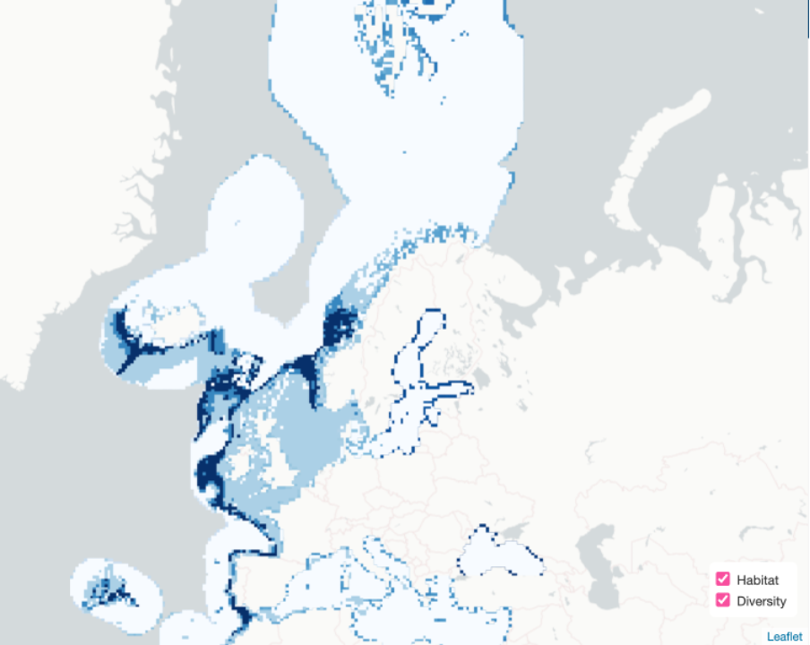
MPA Europe has launched its Online Atlas for Marine Spatial Planning (Atlas for MSP), a freely accessible platform that brings together biodiversity, environmental, and prioritisation data to support the development of marine protected area (MPA) networks across European seas. Published as Deliverable 5.7, the Atlas for MSP offers practical tools for planners, researchers, and policymakers engaged in ocean conservation and management. It can be accessed at the MPA Europe map platform.
A key component of the Atlas for MSP is the use of species distribution models (SDMs) to identify areas of high biodiversity value, now and under future climate scenarios. These models and their role in the MPA Europe project were presented by Silas Principe (OBIS/UNESCO) at the Living Data 2025 conference, held in October in Bogotá, Colombia. His talk, titled Ocean data application for biodiversity inclusive Marine Spatial Planning, was part of the session A Global Ocean Biodiversity Observing System supporting governance framework implementation, which focused on advancing marine biodiversity monitoring to meet international goals, including the Kunming-Montreal Global Biodiversity Framework and the BBNJ Agreement.
In his presentation, Silas explained how SDMs, developed for over 12,000 marine species and six biogenic habitats so far, help capture species–environment relationships, project future distributions under several SSP scenarios, and provide essential input for tools like the Atlas for MSP. These models are especially important in areas where observational data are sparse or uneven, enabling systematic conservation planning that is representative, connected, and resilient.
The Atlas for MSP integrates SDMs with environmental layers, ecosystem classifications, carbon data, and spatial prioritisation results. Although still under development, users can already explore different scenarios for different habitats and animal groups, visualising different measures of diversity. The map illustrating this news, for instance, shows the Local Contribution to Beta Diversity of Fishes overlaying the habitat Corals within European seas. Soon, it will be possible to add EURO-CARBON data points, environmental characteristics, marine regions, environmental and human pressures, and climate projections to the required map. All this within a user-friendly interface designed to support evidence-based decision making. For more details on how to use the MPA Europe Map platform, you can watch this video.
As MPA Europe works to identify optimal areas for marine protection across Europe’s regional seas, the Online Atlas serves as a practical and open-access tool to translate complex data into actionable knowledge — helping to bridge science and policy for marine biodiversity protection.


